
 |
|
|
|
Keynote Speakers
Harry Verwayen- Executive Director Europeana Foundation, the operator of the Europeana platform. Across Europe, museums, galleries and archives digitize their collections. Europeana supports these organisations in their digital transformation by making these collections available as widely as possible so that people can find and use them. For work, for learning or just for fun. Our work is guided by creative collaboration, supportive teamwork and the idea that sharing and reusing cultural content can positively transform the world. Prior to this Harry worked at the Amsterdam based think tank Knowledgeland where he was responsible for business model innovation in the cultural heritage sector. Harry holds a MA in History from Leiden University and has worked over ten years in the Academic Publishing Industry. Mediocre tennis player, reasonable cook, aspiring photographer.
Presentation Title: Culture Shock! Covid-19 & digital transformation of Cultural Heritage
Abstract:
In recent months, culture has shown to be a compelling force: people turned to digital technology and communication to share culture and come together as families, in friendship groups and as communities. Now is the time to look critically at the role of cultural heritage and reimagine it.
Zoller & Fröhlich GmbH
Dr. Christoph Fröhlich is the CEO of Zoller+Fröhlich, one of todays leading laser scanner manufacturers. In 1988, after finishing his studies electrical engineering, he was appointed scientific assistant at the chair for automatic control engineering at the Technical University of Munich. In 1996 he obtained a PhD with the topic “Active generation of corresponding depth and reflectivity images and their use to capture the environment.
In 1994, while still completing his doctorate, Christoph Fröhlich joined his parents' company and in 1996 was appointed another managing director of Zoller + Fröhlich GmbH and bfz Steinmeier GmbH with joint representation rights. Today the siblings Cathrin Fröhlich and Christoph Fröhlich are running the family business successfully in the second generation.
As the first company in the world, a 3D laser scanner for measuring surroundings was successfully launched on the market in 1996. In the following years, this technology was continuously improved, so that it could be used in many areas, including the measurement and documentation of cultural heritage. Since then, many international research projects and international papers have been carried out and the company received numerous international awards, showing the usability of the technology worldwide.
Presentation Title: TLS Documentation of Tangible Cultural Heritage - Challenges and Solutions
Abstract:
Today, terrestrial laser scanners are widely used for the documentation of cultural heritage throughout the world. Over the past decades, scanning has become a lot easier and faster and provides more detail than ever. However, the process of digitization still provides many challenges. This presentation will focus on the different levels of complexities that need to be understood to guarantee successful projects and the best data quality. This includes the complexities of the objects, as well as the technical aspects of laserscanners that are being used for the digitization.
The presentation is held from the perspective of the laserscanner manufacturer Zoller+Fröhlich, who will provide technical insights, show the current state-of-the art technology, and provide an outlook into the future.
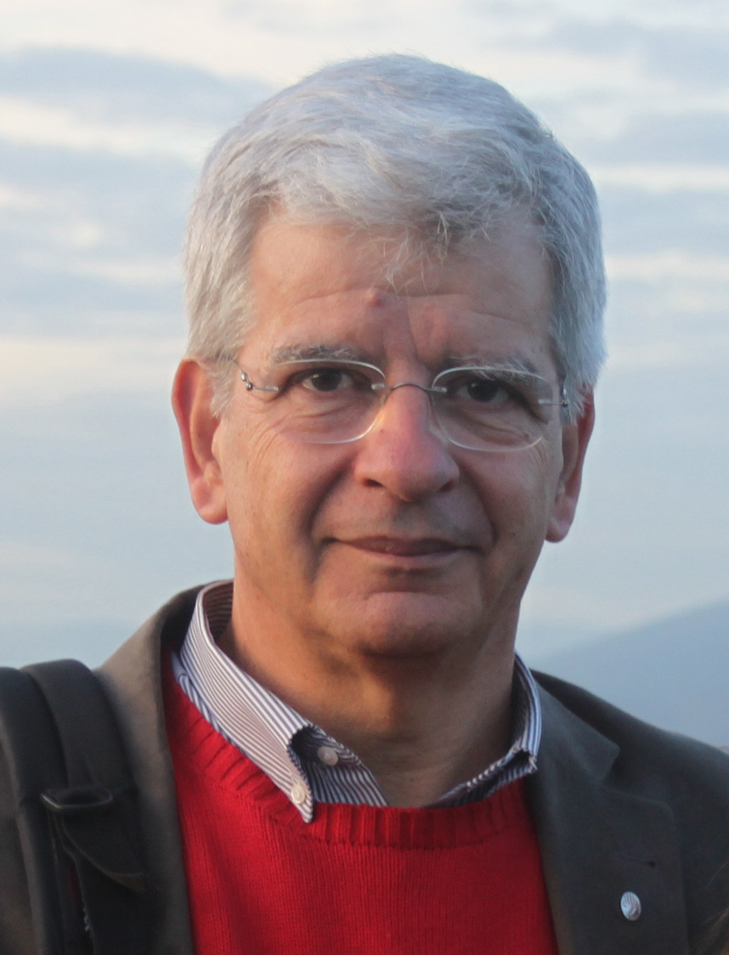
Aristotle University of Thessaloniki, Greece
Petros Patias is a Professor, Director of Laboratory of Photogrammetry & Remote Sensing and ex-chairman at the School of Rural and Surveying Engineering (2003-2007), The Aristotle University of Thessaloniki (AUTH), board member of the Department of Urban Planning, AUTH (2004-2012) and Vice Rector at the University of Western Macedonia (2010-2015), Greece.
Eng. (1981) The Aristotle University, ΜSc (1985) and PhD (1987) both from the Dept. of Geodetic Science and Surveying, Τhe Οhio State University, USΑ.
Chairman of various ISPRS (International Society of Photogrammetry and Remote Sensing) WGs from 1992 onwards, ISPRS Commission V President (2000-2004), CIPA (international Committee for Architectural Photogrammetry) President (2003-2007) and Honorary President (2013-for life), ISPRS Fellow (2016-for life), President of the Hellenic Society of Photogrammetry and Remote Sensing (1992-1996). Visiting Professor at various European universities (TU Delft, ETH Zurich, Universidad del País Vasco).
Editor-in-chief of the “South-Eastern European Journal of Earth Observation and Geomatics” e-Journal (http://ejournals.lib.auth.gr/seejeog), Scientific reviewer to 51 Journals.
Reviewer/evaluation to numerous promotions/elections to all Greek universities. In addition, internationally, he served as evaluator to promotions at National Research Council, Canada (2004), State University of New York, USA (2011), University of Haifa, Israel (2012), Politecnico di Torino, Italy (2015, 2016).
Evaluator to research proposals (besides Greece) to NSERC Discovery Grant Applications, Canada (2013), Research Promotion Foundation Grants, Cyprus (2013), External Evaluation of Higher Education Institutions, Cyprus (2013), Israeli Ministry of Science, Technology and Space Grants, Israel (2014, 2016), Italian Research and University Evaluation Agency (ANVUR) Grants, Italy (2004-2016), Italian Ministry of Education, University and Research (MIUR) Grants, Italy (2015‐2016), Ministry of Education, science and Technological Development Grants, Serbia (2016).
Supervised 101 undergraduate Diploma Theses, 73 MSc Theses and 38 PhD Dissertations.
Published work includes 6 books, 11 chapters in international books and 259 papers in journals and proceedings.
Scientific Responsible, Principal Researcher or member of Research Group to a total of 91 Research Projects funded by European or National Organizations.
Presentation Title: Object Complexity vs. Model Complexity
Abstract:
Object Complexity is of course very important since it has a high impact on various aspects of 3D digitization: it suggests different technologies to be used, it reflects on the required or achievable quality, it may put limits on the intended purpose of use and impacts on the time and budget of survey. Therefore, it is not surprising that that the term “Complexity” is quite often used in CH documentation literature and practice.
What is not expected though, is the fact that it remains a vague term with no clear definition, no subjective methodology of calculating, and no clear connection to Quality, Purpose-of-use, or other imposed restrictions. In other words, the tooling of “Object Complexity” as a decision-support tool is still a gap.
The major function and usefulness of a definition is to clear up concepts and to lead to a fruitful decision-making workflow. However, currently, we discuss the object complexity as a value of its own, which cannot be estimated subjectively, it can be defined only AFTER we make all the measurements on the object (making it useless for 3D digitization planning and decision-making) and it is neutral to intended use (making it useless for choosing the best technology, or setting up the technical specifications for the 3D digitization).
We propose to shift our attention from the “Object complexity” to “Model complexity”. This means that our focus is not the complexity of the real object per se (which is connected to the data capture phase), but the complexity of the produced model (which is connected to the data processing phase). This may look like a conceptual compromise, but the alternatives are worse. Either we ignore this fact, or we make subjective guesses.
Bene Construere, Croatia
Roko Žarnić is Professor of building materials at University of Ljubljana, Faculty for Civil and Geodetic Engineering (UL FGG), since 1993. His research background is in earthquake engineering with a particular interest for built heritage preservation, development of structural elements made of advanced materials (laminated glass and FRP) and inelastic computational models for assessment of structures. He joined the University from the position of director general of Slovenian National Institute for Research in Materials and Structures (ZRMK) where he started his career in 1974. In 1995 he established a Chair for Testing of Materials and Structures at UL FGG and lead it until his retirement from teaching in 2015. After retirement he continues his work as research advisor at University of Ljubljana and in Croatian research SME Bene Construere Ltd. In 1999 he was for six months a Fulbright visiting scholar at University of Colorado at Boulder, CO and in 2006 for six-month national detached expert to EU JRC Laboratory at Ispra, Italy. From 2010 to 2012 he was on duty of Minister of Environment and Spatial Planning of Republic Slovenia.
In European Construction Technology Platform (ECTP) he co-coordinated Focus Area Cultural Heritage (2006-10) and was individual expert appointed in his personal capacity to Horizon 2020 AG for Societal Challenge 5 (2013-2015). He took part in one INTERREG IVc project, seven EUREKA projects, nine COST Actions and 20 FP projects since FP4 till H2020. He coordinated one FP7 project (EU-CHIC).
The last decade he was a partner of several FP7 and H2020 EU funder projects in domain of digital cultural heritage. In April 9 2019 he was chairing the session named ”Cultural Heritage in Digital World” within the World Construction Forum 2019 that took place in Ljubljana, Slovenia. (https://www.wcf2019.org ).
Vlatka Rajčić is Professor of structural engineering at University of Zagreb, Faculty for Civil Engineering (GFUNIZG), since 1992. Her research background is in structural engineering with a particular interest for built heritage preservation, lightweight structures, innovative hybrid structural elements, various computational models for design of structures and use of AI techniques in structural design. She is a licensed structural designer, licensed auditor of structural projects as well as scientific advisor and director of company Bene Construere Ltd., Zagreb, Croatia. She has done numerous designs of retrofitting and sanation projects for immovable tangible heritage. She has done also numerous auditing of the sanation projects in last 20 years. She participated in the development of semantic platforms as a background of the 3D digitization of immovable and movable, tangible cultural heritage; digital data based assessment and Heritage BIM development taking part as beneficiary in projects dealing with digital cultural heritage: H2020 INCEPTION, FP 7 Marie Curie ITN-DCH; as well as in FP7 project Climate for Culture and Smart Monitoring of Historic Structures contributing the projects in the topics of assessment of the structural elements using Non-destructive techniques, drones and by numerical modelling of heritage structures on the influence of climatic loads. She participates in development of the next generation of Eurocode 5 - related to strengthening and retrofitting, of immovable timber cultural heritage; organizes scientific and professional events (e.g. Days of licensed engineers from 2012 till now every year in Croatia).Currently she is a Head of Structural department at the University of Zagreb. She is a Professor, teaching at undergraduate, graduate and postgraduate level courses in Constructive Aspects of Cultural Monuments Protection and Special Chapters in Assessment of Cultural Heritage objects at the postgraduate study, courses in Timber Structures I and II at the university undergraduate study and Structural glass, Aluminum and Membrane, structures as well as the courses Artificial Intelligence in Structural Design and Wood Composites at the postgraduate scientific study. She is the leader of a domestic scientific project, VETROLIGNUM, - a multipurpose CLT-glass hybrid panel, participant and responsible person for the implementation of the 4 FP7 project, 2 Horizont2020 project, 1 FP7 Marie-Curie project and many ERASMUS project. In European Construction Technology Platform (ECTP) she coordinated group Education and Ethics in Focus Area Cultural Heritage (2006-2010) and was individual expert working as evaluator for many FP7 and Horizon 2020 calls (2010-2020). She took part in twelve COST Actions and 6 FP projects since FP6 till H2020. She also coordinated bilateral projects.
Presentation Title: Identification of complexity and quality in 3D documentation by through the significance of cultural heritage assets.
Abstract:
Cultural heritage assets comprise a wide range of tangible and intangible aspects that as a whole determine and enable evaluation of the asset. The inclusive assessment of assets leads to a holistic understanding of the variety of its significances. It enables correct preventive conservation, efficient site management and sustainable use of asset to enable extension of its life supported by self-acquiring of needed funds. However, the need for the holistic but yet in-depth understanding and data exploitation principles is commonly understood by professionals engaged in cultural heritage preservation. The current development of ICT tools and introducing of 3D documentation of heritage assets brings a new momentum to the discipline. In this contribution the importance of identification of significances that defines a particular heritage asset and study of their interaction is presented. It is illustrated by application to the study of heritage assets resilience to natural and man-made hazards, application to analysis of economic potential in heritage assets located in cultural environment and post disaster evaluation of heritage asset that was 3D documented before the occurrence of an earthquake. The illustration is based on the nine groups of significances pertaining to heritage assets that are divided in three subgroups each. It will be put in the context of data collection organized in two major groups: the group of general characteristics of heritage asset and group of characteristics presented in detail. The detailed analysis of complex 3D documentation enables a proper decision making regarding to preventive and post-disaster interventions in heritage assets as well as planning and execution of heritage asset management.
Alastair Rawlinson is Head of Digital Innovation and Learning at Historic Environment Scotland, based at The Engine Shed, Scotland’s Building Conservation Centre. He joined HES in 2017 and is responsible for the strategic development and implementation of innovative digital technologies to directly support conservation of the historic environment, training and education initiatives, and to advance digital accessibility. He has extensive experience in heritage digital documentation and visualisation and specialises in the management and delivery of large scale, complex digital documentation projects. Alastair is a product designer, with a B.Sc. (Hons) from Glasgow Caledonian University. He has almost 20 years’ experience working in the 3D visualisation sector, including 11 years at The Glasgow School of Art, where he undertook digital documentation of an entire city to create the ‘Urban Model of Glasgow’, before leading on the Scottish Ten Project for GSA and co- managing the Visualisation team. He is passionate about 3D technologies and the practical applications of 3D data for the benefit of historic and industrial sites.
Presentation Title: Addressing Complexity and Quality in the Digital Documentation of Immovable Cultural Heritage: The Forth Bridge UNESCO World Heritage Site Case Study
Abstract:
Historic Environment Scotland (HES) is the lead public body established to investigate, care for and promote Scotland’s historic environment. Within HES, we have long advocated the use of innovative digital technologies and increasingly apply these for conservation, asset management, engagement, accessibility and disaster response. We are currently undertaking a large multi-year project to digitally document the 336 properties and thousands of collections objects in the care of HES on behalf of the Scottish Government. The immovable and movable assets we digitally document vary considerably in complexity and we strive for the highest quality possible. This presentation will detail our approach to 3D digital documentation of a large-scale historic engineering structure and live railway bridge – the Forth Bridge UNESCO World Heritage Site.
Prof. Charalabos Ioannidis
National Technical University of Athens, Greece
Dr. Andreas Georgopoulos is full Professor of Photogrammetry and Director of the Lab of Photogrammetry of the School of Rural & Surveying Engineering of NTUA. He holds a Diploma of Surveying (NTUA 1976) and an MSc (1977) and a PhD (1981) in Photogrammetry from University College London. He has been teaching Photogrammetry and Documentation of Monuments since 1980 in UCL, NTUA and as visiting professor in KULeuven (RLICC - ArchDOC), CUT (Dept. of Civil & Geomatics Eng.) and the University of the Aegean. He has been Vice-Head (1998-2002) and Head (2002-2006) of the School of Rural & Surveying Eng. and member of the Research Committee of NTUA since 1999. Since 2006 he is a member of the Executive Board of the ISC of ICOMOS CIPA-Heritage Documentation and has served as Secretary General (2010-2014), President (2015-2019) while currently he is Vice-President. Since 1985, he has participated in numerous research projects of the Lab of Photogrammetry concerning Digital Photogrammetry and Monument documentation. He has published approx. 250 scientific papers in international journals and conference proceedings. His research interests focus on 3D modeling of cultural heritage, photogrammetric automation, and digital contemporary techniques.
Charalabos Ioannidis is a Professor at the Lab of Photogrammetry, School of Rural & Surveying Engineering, NTUA. He is the Dean of the School and the Deputy Director of the Interdisciplinary Programme for Postgraduate Studies in ‘Geoinformatics’. He is the Chair of the Working Group 3.2 ‘Geospatial Big Data: collection, processing, and presentation’, Commission 3 of FIG.
He teaches the courses of Photogrammetry and Documentation of Historical Monuments since 1995. He has published more than 160 papers and another 45 presentations in Conferences. He serves as a reviewer in several peer reviewed journals, books and international conferences. His main research fields include: Cultural Heritage geometric documentation, multi-dimensional modelling, city modelling, automatic change detection, data fusion, satellite photogrammetry, land management, etc.
He has been the scientific supervisor of 12 research projects in the last 15 years, 3 of them are bilateral cooperation with France, Cyprus and Israel; also, he has participated as principal investigator in another 23 research projects, national or international (funded by EU, etc).
Presentation Title: The impact of monument complexity and data quality on the documentation of tangible cultural heritage
Abstract:
The holistic digital documentation of a cultural monuments is widely accepted to be a prerequisite for the preservation of the cultural heritage worldwide. The documentation implies several actions for acquiring the most suitable digital geometric and semantic data for this purpose. This task cannot be independent of the nature and the characteristics of the object, provided that there are detailed specifications for all stages of the documentation, from data collection (data type, techniques), processing (methods, techniques) to products extraction (accuracy, reliability, product type, level of detail). The data acquired include accurate quantitative and detailed qualitative measurements. The more complex the object the more difficult this task is, as it is imperative that care should be taken to acquire all details necessary for the documentation. It is necessary to develop and apply metrics for defining object complexity and the factors affecting it. On the other hand, data and products’ quality should comply with the standards set for each task.
In this presentation the terms of monument complexity and data quality will be defined and analysed and an attempt will be made as to how these characteristics affect holistic digital documentation. A variety of case studies are presented as examples of good practice for different types of monuments, in terms of size, features and products required.
Dr. Raffaella Brumana, Full Professor of Geomatics at the Politecnico di Milano, Head of dABCLab GIcarus
Classic High School. Master Degree in Architecture at the Politecnico di Milano with honours (1989). Ph.D. in Geodetic and Topographic Sciences. Since 07/01/2016 Full Professor (Geomatics), Politecnico di Milano, Dept. of Architecture, Built Environment and Construction Engineering (dABC). Head of DABClab GIcarus (4D BIM-GIS-SDI), Geospatial Information@Content modeling: Architectural heritage & Built environment & EUrbanAtl@s Surveying. She teaches Innovative Advanced Surveying techniques, Surveying&Modelling Techniques within the Preservation Studio Lab at the M.Sc.Arch (AUIC School, 7th position in the Int. QS University Ranking 2020).
Research activities: Digitization, Surveying, modelling and monitoring of Architectural Heritage and Built Environment, Archaeological site. Lidar, TLS, MMS and Photogrammetry, multi-spectral RGB, IRT/NIR images, UAV and satellite data. Geospatial information: informative models, SCANtoBIM, 4D HBIM (Historical Building Information Model &management), VR/AR/MR, Architectural Object Library (vaults, masonry, ceilings) within Common Data Environment. WEB GIS, BIM-GIS, OpenData, Virtual Hub APP, Climate change landscape pressures and mitigation using EO (Copernicus programme).
EU 7FP and H2020 funded research projects (EASEE, GE20, ENERGIC-OD, ALDREN), EU FESR (HOMEBIM liveAPP).
Consulence contracts (Royal Villa of Monza, Milan, Basilica di San Marco, Venice, Basilica di S.Ambrogio, Milan, Milan Cathedral, Arquata del Tronto Earth-quaked hamlet). Basilica di Collemaggio L’Aquila (awarded by Europa Nostra 2020).
2009-2020 Member of the Scientific Board of the POLIMI School of DABC Doctoral Studies and 2001-2009 Department DIIAR.
Arqueológica 2.0 and GEORES GEOmatics and pREServation’, 2021 Valencia, Spain (Co-chair); GEORES2019 (CIPA-ICOMOS, ISPRS event), Chair; EUROMED2018 (Co-chair), 2017 CIPA Ottawa (ICOMOS and ISPRS). Editor /Associate Editor/ Guest Editor Activities and Special issues. More than 200 peer review scientific publications.
PB ECTP EEB PPP Private Public Partnership; E2BA (Energy Efficient Building Association) Steering Committee; SB of UNESCO-OPEN FORUM Mesopotam (Albania). AB ERACHAIR, CUT Cyprus. ICOMOS, CIPA, Copernicus Academy Member.
Internship programmes. 2016-2020 Executive Committee of Partnered Research Training Initiative ‘New Paradigm / New Tools’, Canada SSHRC (Social Sciences and Humanities Research Council, Canadian Government). 2011-2020 ARCHDOC Architectural Heritage Documentation for Conservation, RLICC (Unesco Chair on Preventive conservation and monitoring of monuments and Sites, KUL, Be). FORMAT-EO ERASMUS IP, UK. Traineeship Supervisor, Thesis Supervisor, PhD supervisor and co-supervisor: NTUA (Athens, GR), Kul Leuven, CUT (CY) and others.
Presentation Title: Building and sharing knowledge from quality driven content models
Abstract:
3D models - from passive subjects often reduced to images related to written documents and drawing – have the opportunity to become core digital gears leveraging knowledge, tools through which to decode the complexity of cultural heritage, extract contents, integrate them with multidisciplinary data : a gear of a circular knowledge building process where to connect the reality with its digitization, historical reports and sources, monitoring sensors, conveying information to a differentiated user, scholars, operators and citizen of mankind. In one word ‘live’ digital twins continuously growing within a complex built environment, under the hazards, natural anthropic pressures as climate change, earthquakes.
Still in the limbo of the society of image, between media and big technological potential offered by digitisation, and a substantial under-use in the daily long life cycle maintenance and communication.
To become an active subject of knowledge, they need a qualitative leap towards content creation, content use and content transferring.
Several ingredients can contribute to achieve this result: on one hand the wealth of detail ensured by equipment conjugating massive acquisition with high accuracy, on the other hand advanced processing methodologies supporting representation of the complex geometries capable of capturing the uniqueness of the architectural complex and its components. But precision is not enough. Complex geometries become communicative of complex subjects only if they are reflected in the knowledge of materials, construction techniques, techniques of workmanship and craftsmen handing down such techniques from generation to generation over the centuries.
3D quality models must conjugate geometry with the surface texturing, to let deriving how the geometry is influenced by the construction techniques. A wealth of knowledge that passes through the uniqueness of the subject with its materials and techniques, its ‘habeas corpus’, its identity card crossing the centuries.
3D content models means 3dmodels capable to decode the complexity of behaviour that comes from the stratified results of centuries, the transformation phases impacted by hazards in a fragile context: it means that the out plumbs after an earthquake must relate the anomalies, irregularities and specificities, correlating the reading of the different stratigraphic units with the aim to better understand the disconnections occurred and the differentiated damages in order to drive the preservation role and prevent disjoining with proper connections.
Informative quality models progressively enriched by all the information coming from the BIM uses (materials, decay analysis, construction techniques, decorations, surfaces finishing, structural behaviour, energy performances) can support the preservation design project and decision making process till to the life cycle management. At the same time each piece of research, the single informative model gained – considered as a node - can contribute to the generation of libraries of object across space and centuries, highlighting permanencies and mutations of the construction techniques highlighting the unsuspected richness of components like vault systems through which high quality models digitization is returning to us the history of constructive wisdom and domination of cutting stones in the space (stereotomy) of more complex forms than those that fall within the typological classifications cited in the historical manuals, driving the masonry techniques with a multiplicity of results. It is the case of ‘trompe’ shaping capacity building (Guarino Guarini) or framed vaults across Europe with the art to build in the space complex models saving centrings and fasting the process with uniqueness of variety.
Quality driven model allows building knowledge and building capacities opening the doors of informed communication using co-working spaces, common data environment and geospatial hubs with linked informative model objects (as HBIM), in the form of Linked Open Data (LOD), enriching and augmenting reality also by using VR/AR/MR. This requiring common language exchange and vocabularies taking in account the richness of the subject and technical words within multi-disciplinary languages.
Standardization and ad hoc guidelines addressing the complexity of cultural heritage as in the case of LOD-LOG-LOA-GOA definition in the HBIM can contributes to avoid misunderstanding and misuses in the re-use and circulation of the 3D models, libraries and sites, building capacities and growing DG content skills.
Positions Held: Currently President and Chief Scientist, Global Digital Heritage Inc, a 501c3 non-profit. Formally, Executive Director, Center for Virtualization and Applied Spatial Technologies (CVAST), University of South Florida. Professor, Department of Anthropology and Professor, School of Geosciences, University of South Florida. Visiting Professor, al dipartimento di Scienze Storiche e Beni Culturali, University of Siena; Director and Professor, Idaho Museum of Natural History; Associate and Assistant Professor, Department of Anthropology, Idaho State University.
Research: Virtualization, visualization, informatics, 3D scanning, and public science. Creation of digital research infrastructures that transcend humanities, physical, natural, and social sciences. Digital heritage, digital humanities, museum and research informatics, and digital natural history at regional and global scales. Active projects in France, Spain, Italy, Portugal, Bosnia, Sharjah UAE, Turkey, Uzbekistan, Morocco, Alaska. Methodological interests in 3d imaging, digital heritage, and database construction, elemental and isotopic analyses, geographic information systems, social networks, and complex systems analysis.
Other current specialties in human biocomplexity and the environment, resource and community sustainability, complex systems and modeling, long‐term human impacts and interactions with marine ecosystems, fisheries, ocean modeling, and human ecosystem engineering. Theoretical specialties in evolutionary psychology, warfare and inequality, global historical ecologies, public education and the democratization of science, and virtual museums and repositories.
Grants and Publications: Principal Investigator on ≈$17.6 million in grants, including PI on ≈$5.9 million from the National Science Foundation (22 awards as PI). Published 3 monographs, 9 edited volumes, 1 edited journal section, 118 articles, chapters, reviews (91 peer-reviewed). Also, 30 conferences and symposia organized, 250+ conference presentations with abstracts, 100+ invited lectures, and 50+ professional reports.
Presentation Title: 3D Documentation of Tangible Cultural Heritage: From Scarab Seals to Ancient Cities with the NGO Global Digital Heritage
Abstract:
Global Digital Heritage (GDH) is an international non-profit entity that has scanned more heritage artifacts, sites, and landscapes than any other organization in the world. We do this for free. Specializing in lessor known heritage sites and collections, GDH has projects in ten countries and has over 3000 models on Sketchfab and other platforms. With a fundamental goal of the Democratization of Heritage by making models and collections free to the world, GDH has developed rapid and detailed techniques for the documentation, dissemination, and storage of 3D assists. In the context of these projects, GDH has indirectly addressed and managed the problems identified in the first four Tasks of the European Study on quality in 3D digitisation of tangible cultural heritage.
To solve Task 1 (complexity), we have employed both handheld engineering grade laser scanners and photogrammetry for small items, ground -based photogrammetry and terrestrial laser scanners for larger items and monuments, and aerial photogrammetry and LiDAR for larges sites and landscapes. We have also developed workflows that integrate these data in order to place small artifacts and sites in a broader context.
What makes a quality digital documentation as posed by Task 2? Our simple answer is that if it is of such detail and precision that it can be used for analysis: measurements, color, features, design, manufacture, construction, motifs, and other factors, without having to refer to the original artifact or place, then it is good enough.
When it comes to standards, benchmarks and methodologies to be discussed in TASK 3, GDH has taken a simple approach. Collect as much data as possible with the highest quality possible, and make sure everything is scaled or georeferenced. Everything else can be solved in the computer. But metadata is a larger problem. Not a problem for how the photos or scans were done, but rather, the data on the artifact or site itself – these are the most critical details required for making digital heritage useful.
TASK 4 wants us to “identify and analyse past or ongoing 3D digitisation projects or 3D objects that could serve as benchmarks for 3D digitization.” There are a few interesting and very important projects and groups. A simple perusal of Sketchfab museums and organizations, and some individuals, show that there are projects producing many hundreds of 3D models, most in obscurity, but of very high quality. But the problem is fundamental, we spend to many conferences and workshops talking about 3D data acquisition, and not enough time in the field actually do digital acquisition.
This presentation will present a visual overview of GDH in the context of these four tasks. It will highlight some of our successes, identify our less successful projects, and discuss how these projects have transformed museums, small communities, and regional archaeological administrations.
Sander Münster is J. Professor for Digital Humanities (Object / Images) at the Friedrich-Schiller Universität Jena. He got elected as Secretary of the Time Machine Organisation in 2019 and is responsible for outreach and innovation/business development/partnerships with third parties. Previously, he headed the Department for Media Design at the Media Center at the Technische Universität Dresden and the junior research group UrbanHistory4D. He received his PhD in educational technology from the TU Dresden, where he studied history, education and business. Since 2016 he has been a Young Investigator at the Faculty of Education at the TU Dresden and from 2018 to 2019 visiting professor in computing science. His main research topics are in the visual digital humanities about interdisciplinary teamwork, 4D information systems, 3D reconstruction technologies, bibliometric analysis and investigations on the community as well as business development, funding consultancy and policies.
Presentation Title: Big Data of the Past - Building Blocks towards a virtual Time Machine
Abstract:
What would the world look like if we could access documents from the past as easily as we can access data from the present? Could we use it to make better forecasts for the future? Can historical 4D simulations improve our knowledge of history? Which innovative business models will promote tourism, transport and planning? The Time Machine Organisation (https://timemachine.eu) consists of more than 650 research facilities, GLAM institutions and private companies and currently aims at nothing less than building a time machine as a spatio-temporal scaled digital twin. During a one-year preparatory phase financed by the EU, a 10-year research program for a large-scale research initiative with contributions from more than 1000 scientists was put together. In this presentation the Time Machine Initiative and its planned research program will be presented. Special emphasis is placed on the challenges of capturing and enriching 3D and 4D data from various fields as well as current examples and reference projects of the Time Machine members.
Edward Silverton, Mnemoscene
Ronald Haynes is a University Computer Officer who has been part of academic ICT in the US and UK, including previously as University of Bristol's Computing Service Information Officer, course developer and provider, Arts Faculty Graduate Centre Committee member and postgraduate researcher in Philosophical Theology, and first Webmaster, with the University site short-listed for a national award. Moving to Cambridge first as Computer Manager for Selwyn College, then becoming Deputy IT Manager for the Cavendish Laboratory, he later joined the University Computing Services’ Institution Strategy team - involving liaison, consultancy, course development and provision, professional and community development. Following the IT Review and with the formation of University Information Services, he and the team transitioned to a deeper strategic focus on the needs of selected institutions, as a Relationship Manager for Colleges, as well as a wider responsibility for the needs of the University Information Technology community, as an IT Community Development Manager. Having helped found Cambridge's College IT Management Group (CITMG) and Departmental IT Group (DITG), he remains active in supporting both groups' goals of mutual support and shared solutions. Active technical research interests include collaborative technologies for unifying communications and sustaining distributed and learning communities, cultural and investigative potentials for Augmented Reality, and other complementary physical and virtual 3D technologies. More recently, he has presented and published in the area of the use of Augmented Reality in museums. Formerly he was a consultant, technical writer and editor in Pittsburgh (USA) and London, developing on and publishing about the interworkings of the main micro systems. He is a Governor of St. Mary's School (Cambridge), a Trustee of the Eckhart Society, and holds BCS, ACM, Computer Society, and IEEE membership.
Edward Silverton is a Co-founder of Mnemoscene, with a BSc in Computer Science from Napier University, Edward has 20+ years of experience in web development, 8 of which in the Galleries, Libraries, Archives, and Museums (GLAM) sector. As co-chair of the IIIF 3D Community Group, Edward is a sought-after conference speaker, and is a regular fixture of the international IIIF community conferences, having presented at the Europeana Conference in Lisbon, The Vatican, MoMA New York, The US National Gallery of Art, The Library of Congress, and many other institutions. He is lead developer of the Universal Viewer, a popular open source viewer for cultural heritage content which is the chosen solution for the British Library, National Library of Wales, National Library of Scotland, V&A, and BFI. The Universal Viewer is the primary interface for the British Library’s Save Our Sounds project, and has recently been adopted by Duke University as part of their Morphosource
Presentation Title: IIIF 3D: Complementing IIIF 2D & AV standards with 3D interoperability and sustainability
Abstract:
The IIIF 3D community group https://iiif.io/community/groups/3d/ enables institutions interested in interoperability to coordinate strategies and facilitate conversations about open standards that support 3D use cases. Many of the desired operations and interactions with 3D data are similar to the 2D and A/V use cases of IIIF for sharing images and annotation, and organizations are increasingly looking to integrate exhibits, displays, and comparisons of 3D data with other file types. Two of the IIIF 3D Co-Chairs will share highlights of related projects, experiments and discussions which are helping to evolve possibilities for 3D interoperability and sustainability. Included will be collected user stories and samplings of 3D Workflows For Cultural Heritage, and an introduction to a 3D viewer comparison project - looking at animation, transparency, rendering, view sharing, annotations. In addition some work concerning related model variations, metadata, and persistent identifiers for objects will be shared. There will be an invitation to share additional user needs and stories, to expand a shared understanding of the wider community's requirements, to consider while developing 3D to better fit within existing IIIF standards for 2D, AV, etc.
Carla Schroer, Director of Cultural Heritage Imaging, USA
Doug Boyer is an associate professor in the department of evolutionary anthropology at Duke University in Durham, North Carolina. He has a long history working for museums and with museum collections. In 2013 he launched MorphoSource.org as an archive for 3D data on museum objects. The site now has 12,000 users and hosts data from 1,400 contributors and 500 museum collections. There are 140,000 3D datasets representing 40,000 specimens and 14,000 species of plants and animals. In 2020, MorphoSource 2.0 will be launching having been refactored as a preservation stack committed to open source software used and supported by library and digital humanity communities.
Carla Schroer is co-founder and director of Cultural Heritage Imaging (CHI) a non-profit corporation that develops and implements imaging technologies for cultural, historic and artistic heritage and scientific research. Carla leads the training programs at CHI along with working on field capture projects with Reflectance Transformation Imaging and photogrammetry. She also leads CHI’s software development activities. She spent 20 years in the commercial software industry, managing and directing a wide range of software development projects.
Presentation Title: Documenting and displaying workflows for 3D digital preservation: MorphoSource and CHI’s Digital Lab Notebook
Abstract:
To maximize and robustly maintain the knowledge conveyed by digital representations of natural and cultural heritage materials, standardized, yet flexible systems for documenting workflows of the digitization process are needed. These systems must allow easy updating of records and produce interoperable metadata describing openly understandable and community-supported file formats and structures. To incentivize adoption of this framework, strong attention must be paid to mechanisms that allow a diverse group of stakeholders to derive value from it. We present two different resources aimed at facilitating these goals: The Digital Lab Notebook (DLN) is a software pipeline made up of open source software tools and associated good practices. The DLN provides a greatly simplified, ordinary language-based, nearly automatic method to build the digital equivalent of a scientist’s lab notebook, expressed as CIDOC Conceptual Reference Model (CRM) mapped Linked Data. It is designed for use with computational photography imaging technologies including Reflectance Transformation Imaging (RTI), photogrammetry, and Multi-spectral imaging. Morphosource.org is an openly accessible data repository intended to provide strong support for 3D data representing natural and cultural heritage objects. It is a customized Hyrax instance using a Fedora digital asset management layer and Solr for efficient querying. It uses an entity-event data model for rich and flexible preservation of digitization workflows. For visual discovery and engagement, a variety of kinds of 3D resources can be interactively examined in MorphoSource with VR-ready, open source extensions of the Universal Viewer, a popular open source browser viewer. With data cited in almost 800 scholarly works, the most common users of MorphoSource so far are biologists and museum biodiversity collections.
Dr. Rebecca Dikow - Research Data Scientist, Smithsonian Institution Data Science Lab, USA
Presentation Title: Data-intensive approaches to digitized museum collections
Abstract:
With digitized museum collections objects and associated metadata accumulating rapidly in open access repositories, we are now able to exploit data-hungry machine learning techniques in order to evaluate fundamental research questions as well as to improve accessibility and discoverability of digitized collections and archives for multiple audiences. In this talk, I will detail two initiatives across the Smithsonian Institution that are laying the groundwork to allow us to scale-up in these areas. First, a project that seeks to build deep-learning computer vision models to identify thousands of species of ferns. These models are now being used to ask questions about biogeographic patterns of diversity. Second, work in support of the American Women’s History Initiative to surface stories of women’s contributions to science at the Smithsonian using data from multiple collections databases and archives. Each of these projects serves as an exemplar for how we might implement these techniques at scale across the 19 museums, 9 research centers of the Smithsonian and other collections-based and cultural heritage institutions around the world.
Martin Schaich - Chief Executive Officer, ArcTron 3D GmbH, GERMANY
Presentation Title: The "hen-egg" metaphor in CH: what comes first budget or task? Three exemplary projects from archaeology and monument conservation
Abstract:
The "hen-egg" metaphor, known since antiquity, refers to the question of a causal chain whose events represent cause and effect. A problem - comparable in a broader sense - occurs in numerous publicly announced "Cultural Heritage" 3D documentation and 3D visualization projects. For professional service providers, the question always arises: is price or quality decisive? Or in other words: why is price alone often the award criterion in many CH projects today?
Rarely is the project-specific task defined so comprehensively in terms of quality, complexity and quantity or definable for the tendering bodies that there would not be massive leeway in the price calculation. Correspondingly, the fluctuation range in the bids is enormous in many competitions!
The question arises as to how and whether a competition with possible budget frameworks or budget ceilings could be designed in which basic quality criteria are defined, but in which the competitor is given the opportunity to show what he is able to achieve specifically for the available budget. In the current VIGIE2020/654 study of the European Union exactly such connections are under discussion, which we try to approach as external partner of this study. In order to further circumscribe the problem in an exemplary way, the talk will present three different projects of our engineering office specialized in CH in more detail and will analyze them regarding their value chains.
The first project is the comprehensive and, in many areas, sub-millimeter accurate surveying and modeling of the interior and inventory of the former monastery church St. Michael in Bamberg, which is part of the cultural world heritage and currently Germany's largest church restoration project. The budget available here in the small 6-figure Euro range enabled us to propose and realize a comprehensive, high-quality 3D documentation concept, which also includes the sustainable later use of the data. In the second project a well-known archaeological site, the famous Mycenaean palace castle of Tiryns (Greece) was 3D surveyed for an exhibition project and reconstructed and visualized in two Mycenaean phases (1250/1200 AD). The example shows how a flexible surveying approach was used to respond to challenges encountered on site and which contents could be implemented within a medium 5-digit Euro budget.
As a third project, we present a company-internal trainee project that was created with a minimal 4-digit budget within the current Corona Shutdown 2020. It is a small but interesting Romanesque church near our headquarter, which was documented in a short time but with comprehensive combined technologies and presented during the virtual "Open Monument Day" 2020. Finally, the projects are summarized with regard to their possible character for the exemplary definition of budget-dependent, qualitative and quantitative standards.
Dr Isto Huvila - Professor in Information Studies at Uppsala University, SWEDEN
Presentation Title: What all is (not) paradata? Documenting the making and provenance of archaeological and heritage information
Abstract:
We might have enough data about archaeological data and collections but not a good enough understanding of how the data and collections came about. Current digital documentation and collection management systems provide increasingly comprehensive and easy-to-use functions to keep track of what happens when data and objects are managed and manipulated within the systems. The digital lifecycle within dedicated systems is still only a part of everything that has an influence on how data and collections come into being and what their current and future users might need to know about it to make them usable and useful.
The on-going CAPTURE research project investigates what information about the creation and use of research data (i.e. paradata) is needed and how to capture enough of that information to make the data reusable in the future. The wickedness of the problem lies in the practical impossibility to document and keep everything and the difficulty to determine how to capture just enough to complement information that is already available in the collection data itself and that can be deduced by combining available direct and indirect evidence.
This presentation explores the question of what all things might count as 'paradata' i.e. data that can inform future users of the processes relating to how data and collections have come into being. It stresses the importance of thinking about paradata and the processes of making, broader than as a linear list of events.
Patricia Harpring - Managing Editor, Getty Vocabulary Program, Getty Research Institute, USA
Presentation Title: Vocabularies for Access to History and New Knowledge: Focus on the Getty Vocabularies
Abstract:
This paper discusses the roles of standards generally, and Getty Vocabularies in particular, for enabling good documentation within an institution, for sharing data across institutions, and for allowing access and discovery in the evolving field of digital art history. The Getty Vocabularies comprise the following resources: Art & Architecture Thesaurus (AAT)®, Getty Thesaurus of Geographic Names (TGN)®, Union List of Artist Names (ULAN)®, Getty Iconography Authority (IA)™, and Cultural Objects Name Authority (CONA)®. The Vocabularies contain structured terminology for art, architecture, decorative arts, archival materials, visual surrogates, conservation, and bibliographic materials. Compliant with international standards, they provide authoritative information for catalogers, researchers, and data providers. The Getty Vocabularies strive to be ever more multilingual, multicultural, and inclusive. In this paper, we will explore the features of the Vocabularies, elements of content and linking, international cooperation in their creation, and the methods of release and implementation of the Getty Vocabularies.
Maximilian Nowottnick, Data Scientist at Supper & Supper GmbH, GERMANY
Presentation Title: How 3D Deep Learning solutions can improve the inventory of Cultural Heritage
Abstract:
It is nothing new that 3D point clouds have a big potential to transform the way we used to capture the real world and extract valuable information out of it. The question is how to leverage this potential. Recent advances in 3D Deep Learning research show that the time is here to not only have digital twins but to apply AI solutions on 3D data. However, there is still a lack of end-to-end solutions, where you can manage, classify and analyze your point clouds.
This is where Pointly and Pointly Services steps in. With Pointly, as an accelerated manual annotation tool, you can label your point clouds in a customized and easy way and generate training data faster than ever before for your AI case. Moreover, you can manage and store your data cloud-based, where data can be organized by feature classes, categorizations, lists and tags to make it valuable for further processing. However, Pointly Services offer the possibility to utilize the training data to train a Deep Learning algorithm to detect whatever matters to you. But simple automated detection is not the end of the line – there are many more AI solutions realizable like comparison between conditions of artifacts, height, or volumes of objects or to convert annotations into shape layers or other data formats.
In this talk we will present Pointly and showcase how we applied Deep Learning on 3D point clouds to tap the full potential of this data.
Diofantos Hadjimitsis, Prof. Cyprus University of Technology - EXCELSIOR H2020 Teaming Project & Eratosthenes Centre of Excellence, CYPRUS
He is a Full Professor at the Department of Civil Engineering and Geomatics of the Cyprus University of Technology. He is the Managing Director of the ERATOSTHENES CENTRE OF EXCELLENCE/ERATOSTHENES CoE https://www.eratosthenes.org.cy and coordinator of the EXCELSIOR Teaming H2020 Project (www.excelsior2020.eu). He is the member of the Board oF ‘The Cyprus Agency of Quality Assurance and Accreditation in Higher Education (CYQAA)’ (https://www.dipae.ac.cy/). Diofantos G. Hadjimitsis was the Vice-Rector of Academic Affairs of the Cyprus University of Technology (2016-2019). He was the Chair of the Department of Civil Eng. and Geomatics from 2011 to 2015. He was the member of the National Experts appointed by the Cyprus Government for investigating the potential of Cyprus to join the European Space Agency (ESA) on 2009. He appointed from the Cyprus Research Promotion Foundation as a national delegate/contact point for the FP7 framework in the 'SPACE' on 2011. He has been nominated and elected as SPIE Senior member 2014 for his achievements in remote sensing. He worked in the past at the University of Southampton (UK), University of Surrey (UK) and Frederick Institute of Technology (CY). He worked also in the construction industry (roadworks, highway engineering, project management) a well in the remote sensing industry. He is a member of the Technical Chamber of Cyprus (ETEK), EARSeL (national representative), ISPRS, NEREUS. He is the leader of the Mediterranean Regional Information Network (MedRIN) GOFC/GOLD/ NASA.
Diofantos holds the following educational qualifications: PhD in Remote Sensing: University of Surrey, Department of Civil Engineering, UK. (1996-1999), MPhil in Remote Sensing: University of Surrey, Department of Civil Engineering, UK. (1996-1997), BEng (Honours) in Civil Engineering (First Class Award): University of Surrey, Department of Civil Engineering, UK. (1994-1996), Higher National Diploma in Civil Engineering (Distinction): Higher Technical Institute, Cyprus (1989-1992) and MSc in Real Estate & Property Management (Distinction): University of Salford, UK (2005-2007)
He has significant experience in research projects that include earth observation, remote sensing, GIS, field spectroscopy, geomatics and civil engineering. He has more than 450 publications in journals, conference proceedings, and chapters in books and monographs in the field of remote sensing and GIS. He has supervised 13 PhD researchers and 150 bachelor and master final year projects and dissertations in the fields of remote sensing, GIS, civil engineering, surveying engineering and geomatics. He is the co-coordinator of MSc in Geo-informatics and Geospatial Technologies at CUT. He has participated in more than 70 funded projects and since his appointment at the CUT (2007) (> 30 research projects as a coordinator) with funding sources from FP6, FP7, Horizon 2020, Interreg, ECHO, Eureka, Life +, MED, Marie Curie, ERASMUS+, COST, ESA, EC regional funds, national funds such as the Cyprus Research Promotion Foundation (CRPF) and industry. He is the member of the editorial team of the 'Open Geosciences' and MDPI Remote Sensing, MPPI Heritage, MDPI Sensors etc. He is the coordinator of the ‘EXCELSIOR’ H2020 Teaming Project (https://www.excelsior2020.eu). The EXCELSIOR (ERATOSTHENES: EΧcellence Research Centre for Earth Surveillance and Space-Based Monitoring of the Environment) is a newly granted project from the Horizon 2020 Framework for Research and Innovation of the European Union (Grant Agreement number: 857510). Through the EXCELSIOR Horizon 2020 Widespread Teaming Phase 2 project, a new, autonomous and self-sustained Centre of Excellence, the ERATOSTHENES Centre of Excellence (ECoE) has been established based on the existing 12 years of the research capacity of the Remote Sensing and Geo-Environment Lab of the Department of Civil Engineering and Geomatics of the Cyprus University of Technology. The total funding of the EXCELSIOR H2020 Teaming project is: 15 million Euros from EC, 15 million Euros from the Republic of Cyprus and 8 million Euros from the Cyprus University of Technology.
Presentation Title: The EXCELSIOR H2020 Teaming Project: Earth Observation & Geoinformatics Research and Innovation agenda for Cultural Heritage